
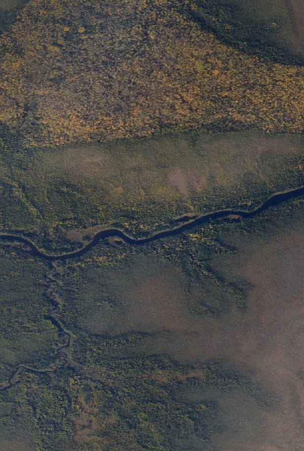
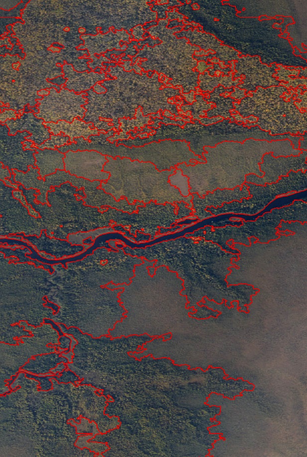
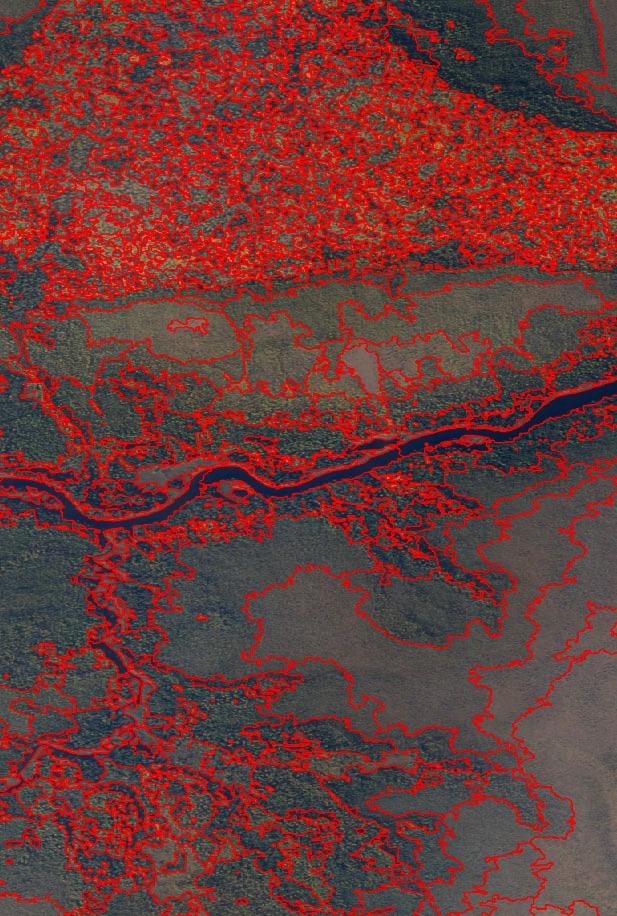
For this project, we helped plan flight and image acquisition parameters to collect high-resolution (20 cm/pixel) aerial imagery of large extents of boreal habitat in northern Ontario from a small airplane, at a fraction of the cost of hiring a traditional airphoto provider. We then performed photogrammetric post-processing of the imagery, generating GIS-ready georeferenced orthomosaics and digital surface models. Finally, we used state-of-the-art image segmentation techniques to partition the imagery into distinct habitat components.
|
|
|